Rain gone, but river rising fast
Published 4:26 pm Tuesday, February 26, 2013
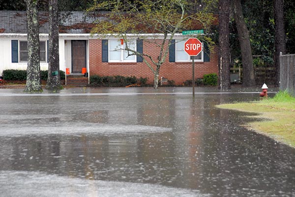
ROUTE BLOCKED: Water covered the intersection of East College Street and Wheat Avenue in Bainbridge on Tuesday, causing visitors to Bainbridge Middle School and school buses to take alternate routes onto the campus.
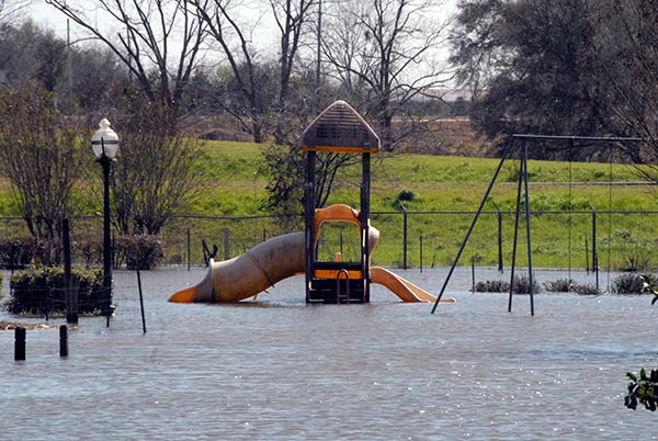
UNDER THE WATER: The city park near the intersection of Washington and Louise Streets was submerged Tuesday as the adjacent drainage pond filled up beyond its capacity.
The deluge of rain that began last Friday finally ended Tuesday, as Bainbridge residents awoke to sunny weather. However, the new concern was the rapid rise of the Flint River and Spring Creek and their potential to flood.
From the start of rainy conditions early last Friday through Tuesday morning, 10.2 inches of rainfall had been recorded at the Decatur County Public Works office on Airport Road, according to Public Works Director Dennis Medley.
The Flint River at Bainbridge was at 23.67 feet as of 2:45 p.m. Tuesday, according to the U.S. Geological Service. The flood stage is 25 feet. The Flint River is forecast to reach 25 feet at 7 a.m. on Wednesday and crest at 28.3 feet at 7 p.m. on Friday night, according to the National Weather Service.
The most significant flood in the past few years was in April 2009, when the Flint River crested at 30.36 feet on April 6.
For comparison, the Flint River crested at 37.7 feet during the Flood of 1994.
Decatur County Emergency Management Agency Director Charlie McCann said no emergency planning meetings are currently scheduled, but said he and other officials such as Sheriff Wiley Griffin are monitoring river conditions.
McCann noted that the properties along the Flint River that might be affected by the flooding were included in a recent Federal Emergency Management Agency flood buyout program. However, McCann said low-lying sections of roads in riverside subdivisions like Flint River Heights and River Vale will be affected.
Spring Creek at Iron City was at 18.80 feet as of 3:15 p.m. Tuesday. The flood stage is 16 feet. Spring Creek is forecast to peak at 20.23 feet at 9 a.m. on Wednesday.
McCann said that flood waters on the Spring Creek may approach homes along Yates Spring Road and near Smith Landing.
The county’s public works department responded to several reports of trees falling on roadways.
Bainbridge Public Services workers were busy Monday checking streets and sewer catch basins to make sure water didn’t build up. Some residents also reported losing power on Monday night.
The Washington Street park, located south of West College Street, was partially underwater and water had spread to adjacent streets.
The intersection of College Street and Wheat Avenue, next to Bainbridge High School, was closed Monday after rain water pooled up.
Some of the other areas affected by standing water included: College Road at Wyndham Way, Lake Douglas Road near the old red barn and Alice Street in front of Wal-Mart.
The following is a list of Decatur County Public Works road closures, as of 3 p.m. Tuesday:
• Country Club Road is back open
• The Spring Creek landing road underneath the Brinson Bridge
• Whispering Pines (from address 140 to 157)
• Tom Maxwell Road (from address 172 to the intersection with Robert Mitchell Road)
• Palmer Road (from Friendship Cemetery to the intersection with Old Whigham Road)
• Hatcher Road (address 1063 to 1139)
• Rich Road (from address 278 to 365)
• Johnny Skipper Road
• Batten Road
• Swanwall Road (from Swanwall Church to the intersection with Brinson Air Base Road)
• Open Pond Road (from address 1207 to 1307)